Apply Urban Scale Mapping Techniques Using SketchUp
Skills:
AI Workflow Automation60%
Key Takeaways
Applies Urban Scale Mapping Techniques Using SketchUp and AutoCAD
Original Description
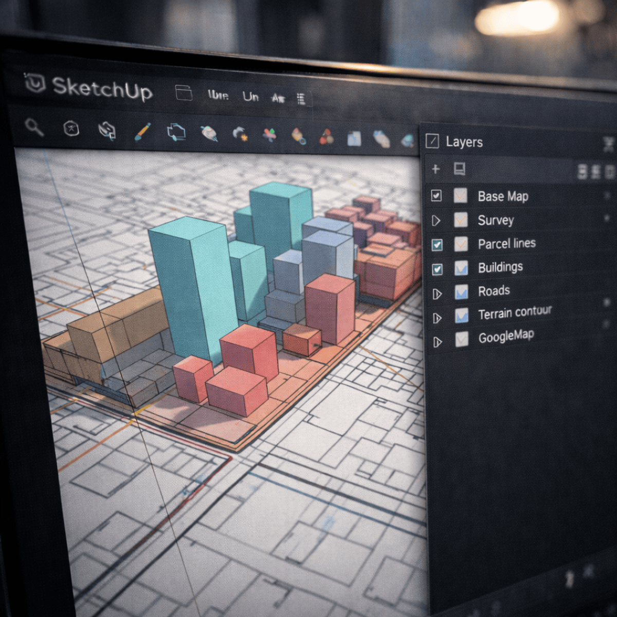
By the end of this course, learners will be able to interpret urban survey data, prepare structured AutoCAD drawings, develop urban-scale base maps, apply efficient SketchUp mapping techniques, and communicate design outcomes through professional presentations. Learners will also be able to organize large-scale spatial data using logical layers, color hierarchies, and simplified massing strategies suitable for urban analysis and visualization.
This course provides a practical, end-to-end workflow for creating urban-scale maps and presentations using industry-relevant tools such as AutoCAD, SketchUp, and PowerPoint. Learners will progress from understanding real-world survey plans to building accurate 3D urban base maps and refining them for clarity and performance. The course emphasizes scalable modeling techniques, visual hierarchy, and clear communication rather than excessive detailing, making it ideal for urban design, planning, and architectural visualization contexts.
What makes this course unique is its case-study-driven approach focused specifically on urban-scale mapping, not isolated buildings. Learners gain hands-on exposure to a streamlined professional workflow that bridges technical drawing, 3D mapping, and presentation skills—enabling them to produce clear, compelling urban visualizations suitable for academic, professional, and portfolio use.
Watch on External: Coursera ↗
(saves to browser)
Sign in to unlock AI tutor explanation · ⚡30
More on: AI Workflow Automation
View skill →


Related Reads
📰
📰
📰
📰
Selecting Your AI Tool Stack: A Three‑Layer Framework for Solo Travel Consultants
Dev.to AI
How to prepare TIC teacher exams in Spain with AI (oposiciones 2026)
Dev.to AI
AI Tools that Actually Pay You Back: A Developer's Guide to Monetizing AI
Dev.to AI
How to Summarize PDFs Programmatically in 2026 (+ a Free No-Code Option)
Dev.to · Ai tools overview
🎓
Tutor Explanation
